
Valli del delta del Po v1.4 Seasons redy with local clima FS17
EN
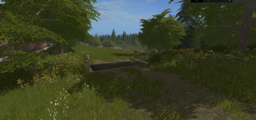
In the unquestionably unique profile of the Po Delta there is the territory created both by the sedimentation of the river and by the work of man who over the centuries has regimented the waters and reclaimed the land. In the Delta area, nature, history, tradition, culture and art intertwine, offering the visitor a new and surprising landscape. In the Delta there are various environments, each with peculiar characteristics: the countryside with the paleoalvei, the fossil dunes, the banks, the floodplains, the fishing valleys, the lagoons or the sacks and the sandbars. These elements of the landscape meet coming from the east, descending along the current of the Po and then we will follow this order to enter the Delta.
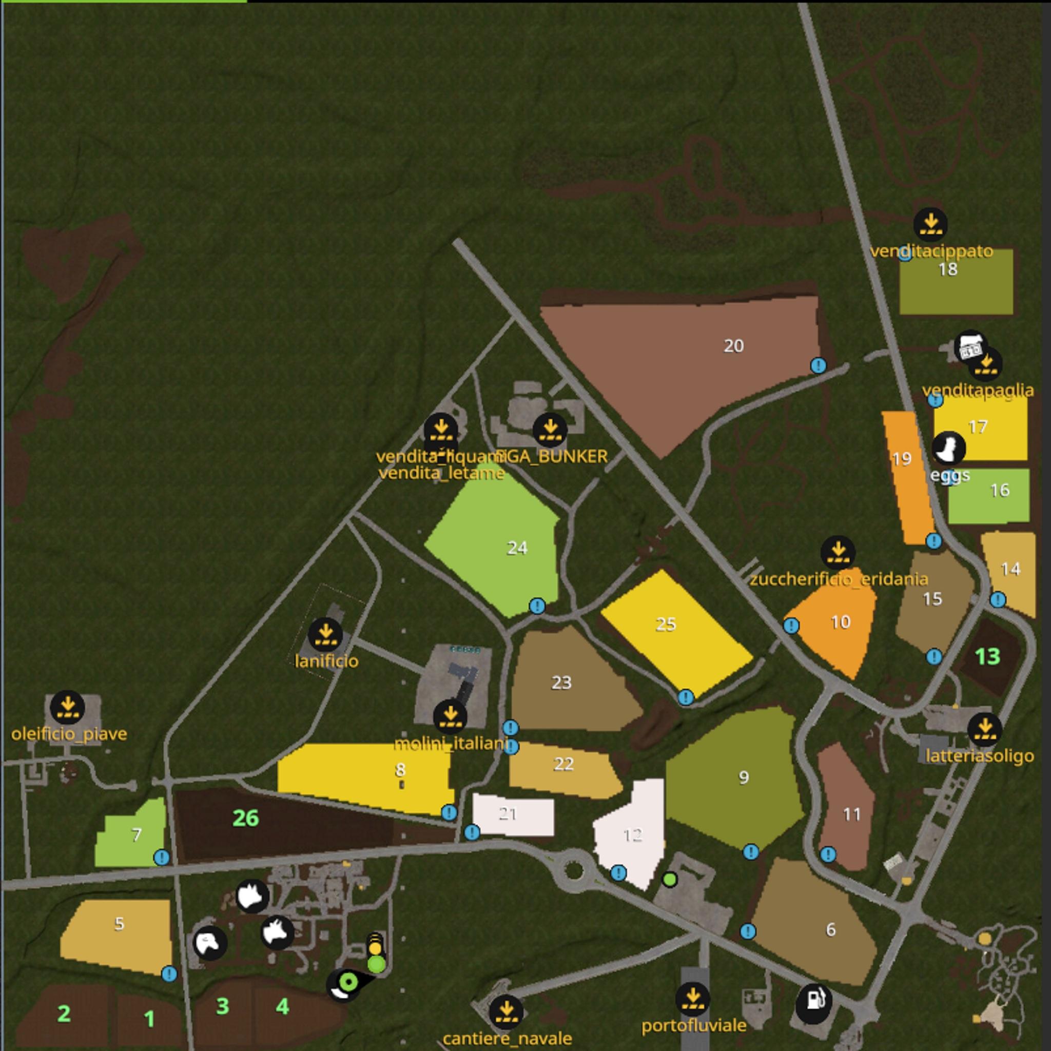
Currently the Po Delta is completely below sea level, except for embankments, sandbars and fossil dunes. The water management is under the control of the Delta Po-Adige Reclamation Consortium that manages an important drainage system with a draining system of 6000-7000 kw of power able to raise one billion cubic meters of water a year by placing it in the drainage channels.
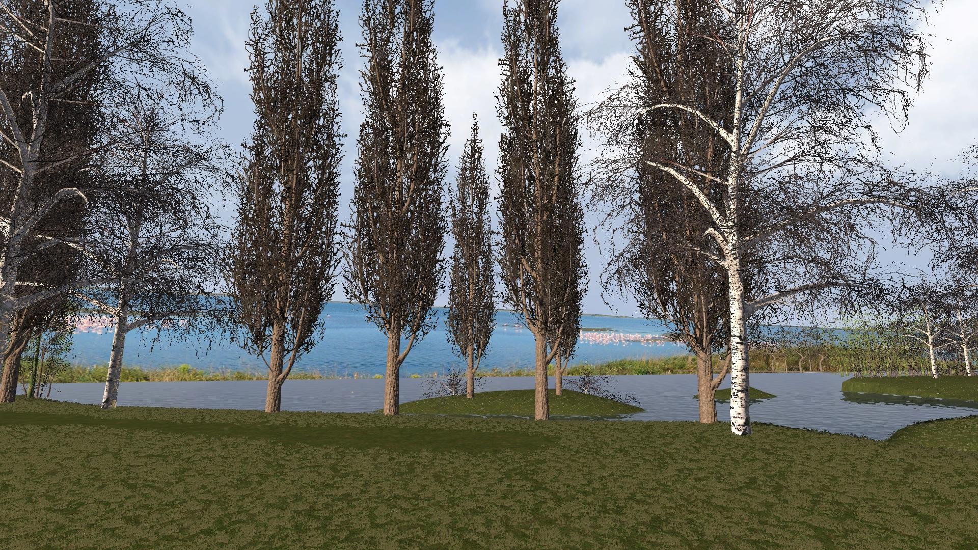
the environment of the Delta furthest from the sea and is characterized by the absence of visible slopes, by a uniform ground and by the regular shape of the drainage net. You do not immediately perceive the difference between the Delta and the Po Valley, apart from a certain rarefaction of the most imposing trees and poplars. Also visible are the paleoalvei, ancient abandoned riverbeds, a complex of signs on the territory left by the activity of the rivers. They are configured as long series of bumps, even a few hundred meters wide, measured by 1-2 meters on the countryside level. The Delta campaign is a land of reclamation formed by the drying up of large pools of water and is very fertile, used entirely for agricultural and horticultural activities. As you approach the sea, the land changes its shape and goes from peaty to sandy. Even the colors change and make you understand the youth of the earth, going from a very dark gray, almost black, to a pearl gray.
DE
In dem unbestreitbar einzigartigen Profil des Po-Deltas befindet sich das Gebiet, das sowohl durch die Sedimentation des Flusses als auch durch die Arbeit des Menschen geschaffen wurde, der im Laufe der Jahrhunderte die Gewässer reguliert und das Land wiedergewonnen hat. Im Deltagebiet verbinden sich Natur, Geschichte, Tradition, Kultur und Kunst und bieten dem Besucher eine neue und überraschende Landschaft. Im Delta gibt es verschiedene Umgebungen mit besonderen Eigenschaften: die Landschaft mit dem Paleoalvei, die fossilen Dünen, die Ufer, die Auen, die Fischtäler, die Lagunen oder die Säcke und die Sandbänke. Diese Elemente der Landschaft treffen sich vom Osten her kommend, entlang der Strömung des Po absteigend und dann werden wir dieser Reihenfolge folgen, um in das Delta einzutreten.
Derzeit befindet sich das Po-Delta vollständig unter dem Meeresspiegel, mit Ausnahme von Dämmen, Sandbänken und fossilen Dünen.
Die Wasserwirtschaft steht unter der Kontrolle des Delta Po-Adige Reclamation Konsortiums, das ein wichtiges Entwässerungssystem mit einem Drainage-System von 6000-7000 kW Leistung verwaltet, das in der Lage ist, jährlich eine Milliarde Kubikmeter Wasser in den Entwässerungskanälen anzulegen .
Die am weitesten vom Meer entfernte Umgebung des Deltas ist gekennzeichnet durch das Fehlen sichtbarer Abhänge, durch einen einheitlichen Boden und durch die regelmäßige Form des Entwässerungsnetzes. Den Unterschied zwischen dem Delta und der Po-Ebene spürt man nicht, abgesehen von einer gewissen Verdünnung der imposantesten Bäume und Pappeln. Zu sehen sind auch die Paläoalvei, alte verlassene Flussbetten, ein Komplex von Zeichen auf dem Gebiet, das von der Aktivität der Flüsse verlassen wurde. Sie sind als eine lange Reihe von Unebenheiten konfiguriert, sogar einige hundert Meter breit, gemessen von 1-2 Meter auf dem Landniveau. Die Delta-Kampagne ist ein Land der Rekultivierung, das durch das Austrocknen großer Wasserbecken entstanden ist und sehr fruchtbar ist und ausschließlich für landwirtschaftliche und gartenbauliche Aktivitäten genutzt wird. Wenn Sie sich dem Meer nähern, ändert sich das Land von torfig zu sandig. Sogar die Farben verändern sich und lassen Sie die Jugend der Erde verstehen, die von einem sehr dunkelgrauen, fast schwarzen zu einem Perlgrau wechselt.
FR
Dans le profil incontestablement unique du delta du Pô, il y a le territoire créé à la fois par la sédimentation de la rivière et par le travail de l’homme qui, au fil des siècles, a enrobé les eaux et reconquis le sol. Dans la région du Delta, nature, histoire, tradition, culture et art se mêlent, offrant au visiteur un paysage nouveau et surprenant. Dans le Delta, il existe différents environnements, chacun avec des caractéristiques particulières: la campagne avec les paléoalvéas, les dunes fossiles, les rives, les plaines inondables, les vallées de pêche, les lagunes ou les sacs et les barres de sable. Ces éléments du paysage se rencontrent en provenance de l’est, descendant le long du courant du Pô et nous suivrons ensuite cet ordre pour entrer dans le delta.
Actuellement, le delta du Pô est complètement au-dessous du niveau de la mer, à l’exception des remblais, des barres de sable et des dunes fossiles. La gestion de l’eau est sous le contrôle du consortium de réhabilitation Delta Po-Adige qui gère un important système de drainage avec un système de drainage de 6000-7000 kW de puissance capable de recueillir un milliard de mètres cubes d’eau par an dans les canaux de drainage. .
l’environnement du Delta le plus éloigné de la mer et se caractérise par l’absence de pentes visibles, par un sol uniforme et par la forme régulière du filet de drainage. On ne perçoit pas immédiatement la différence entre le Delta et la vallée du Pô, à part une certaine raréfaction des arbres et des peupliers et des berges les plus imposants. Sont également visibles les paléoalvéas, anciens lits de rivières abandonnés, un complexe de signes sur le territoire laissé par l’activité des fleuves. Ils sont configurés comme de longues séries de bosses, même de quelques centaines de mètres de large, mesurées à 1 ou 2 mètres au niveau de la campagne. La campagne Delta est une terre de réhabilitation formée par l’assèchement de grands bassins d’eau et est très fertile, entièrement utilisée pour les activités agricoles et horticoles. À l’approche de la mer, la terre change de forme et passe de la tourbe au sable. Même les couleurs changent et vous font comprendre la jeunesse de la terre, passant d’un gris très foncé, presque noir, à un gris perle.
IT
Nel profilo indiscutibilmente unico del Delta del Po c’è il territorio creato sia dalla sedimentazione del fiume sia dall’opera dell’uomo che nel corso dei secoli ha regimentato le acque e bonificato la terra. Nell’area del Delta, natura, storia, tradizione, cultura e arte si intrecciano, offrendo al visitatore un paesaggio nuovo e sorprendente. Nel Delta ci sono vari ambienti, ciascuno con caratteristiche peculiari: la campagna con i paleoalvei, le dune fossili, le rive, le pianure alluvionali, le valli da pesca, le lagune o i sacchi e i banchi di sabbia. Questi elementi del paesaggio si incontrano venendo da est, scendendo lungo la corrente del Po e quindi seguiremo questo ordine per entrare nel Delta.
Attualmente il Delta del Po è completamente sotto il livello del mare, ad eccezione di argini, banchi di sabbia e dune fossili. La gestione delle acque è sotto il controllo del Consorzio di Bonifica Delta Po-Adige che gestisce un importante sistema di drenaggio con un sistema di drenaggio di 6000-7000 kw di potenza in grado di sollevare un miliardo di metri cubi di acqua l’anno collocandolo nei canali di drenaggio .
l’ambiente del Delta più lontano dal mare ed è caratterizzato dall’assenza di pendii visibili, da un terreno uniforme e dalla forma regolare della rete di drenaggio. Non si percepisce immediatamente la differenza tra il Delta e la Pianura Padana, a parte una certa rarefazione degli alberi, dei pioppi . Sono visibili anche i paleoalvei, antichi letti dei fiumi abbandonati, un complesso di segni sul territorio lasciato dall’attività dei fiumi. Sono configurati come una lunga serie di dossi, anche di poche centinaia di metri, misurati a 1-2 metri sul livello della campagna. La campagna del Delta è una terra di bonifica formata dall’essiccamento di grandi pozze d’acqua ed è molto fertile, utilizzato interamente per attività agricole e orticole. Mentre ti avvicini al mare, la terra cambia forma e passa da torboso a sabbioso. Anche i colori cambiano e ti fanno capire la giovinezza della terra, passando da un grigio molto scuro, quasi nero, a un grigio perla.